Oatley Flora and Fauna Conservation Society would like to acknowledge the Bidjigal people of the Eora nation, the Traditional Custodians of the land through which this track passes and pay respects to Elders past, present and emerging.
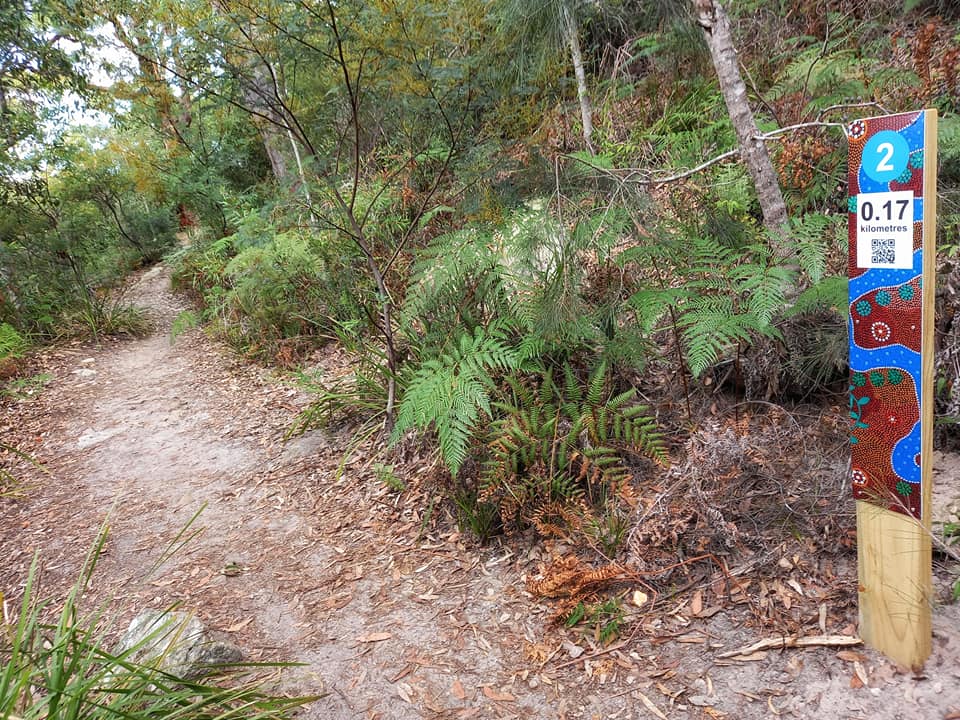
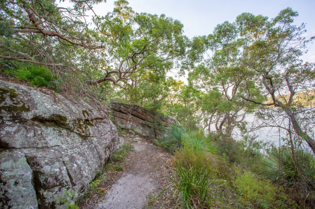
This walk in Oatley Park begins at the car park south of the Castle. Follow the path down the steps towards the water. The track veers off to your right, looping around the headland through natural bushland once widespread in the St George area. The track (Grade 2) takes around 40 minutes. it is 1.3 km with steps at the start and steps midway along the track, otherwise it is mostly flat.
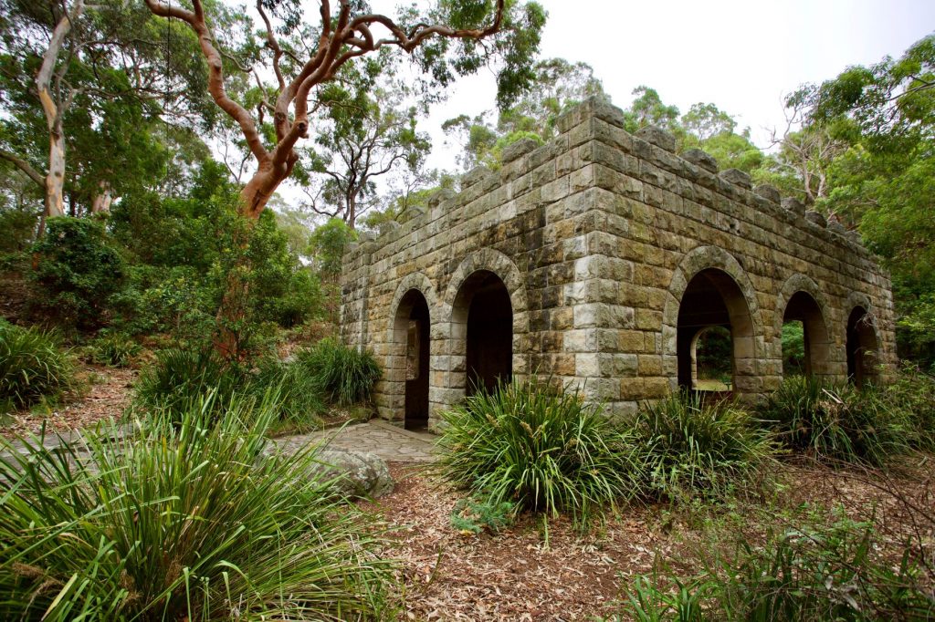
The sandstone building with the castle like appearance was built by men on work-relief schemes during the Great Depression (c 1935). It was designed as a shelter and viewing platform and for some years served as a kiosk. Many similar structures were built in other parklands around this period and are solid reminders of the practice at that time of decorating rather than blending in with the bush surroundings.
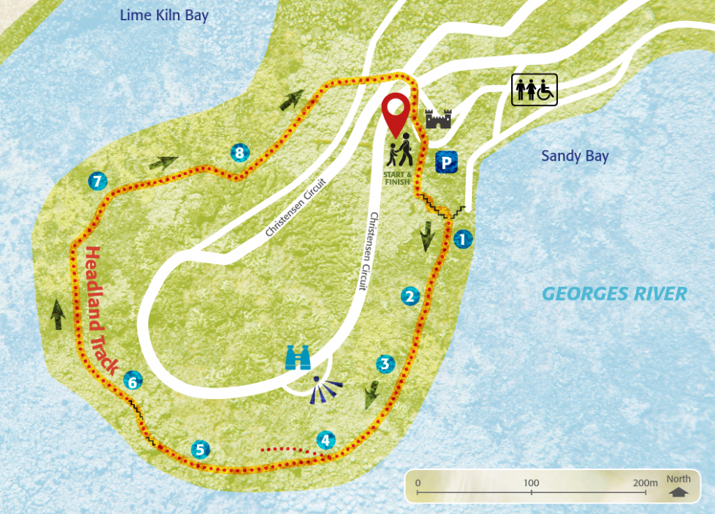
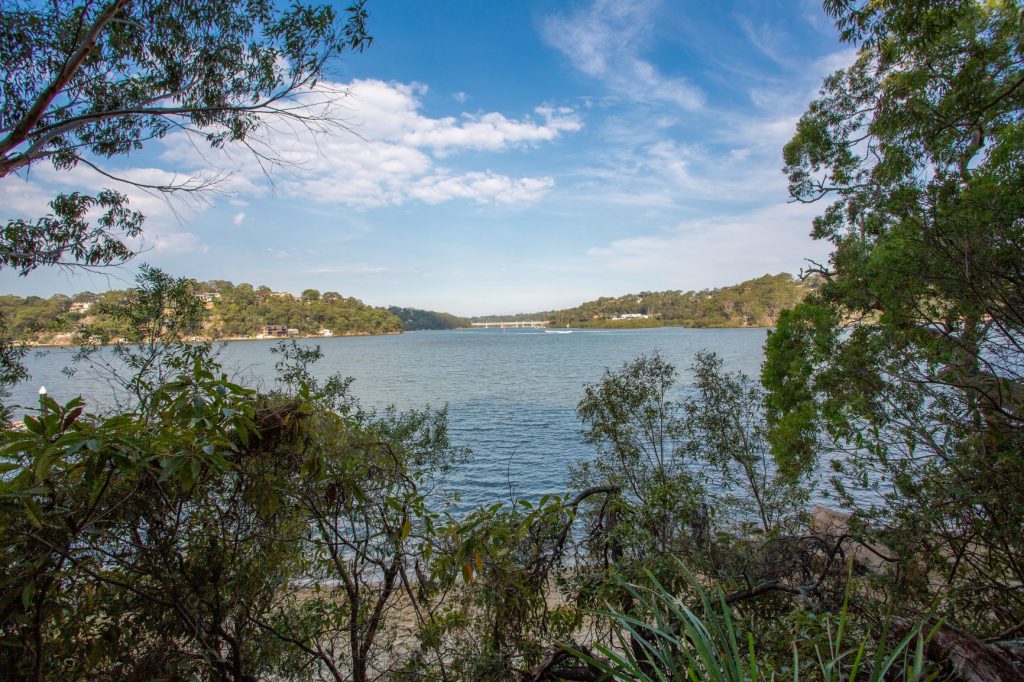
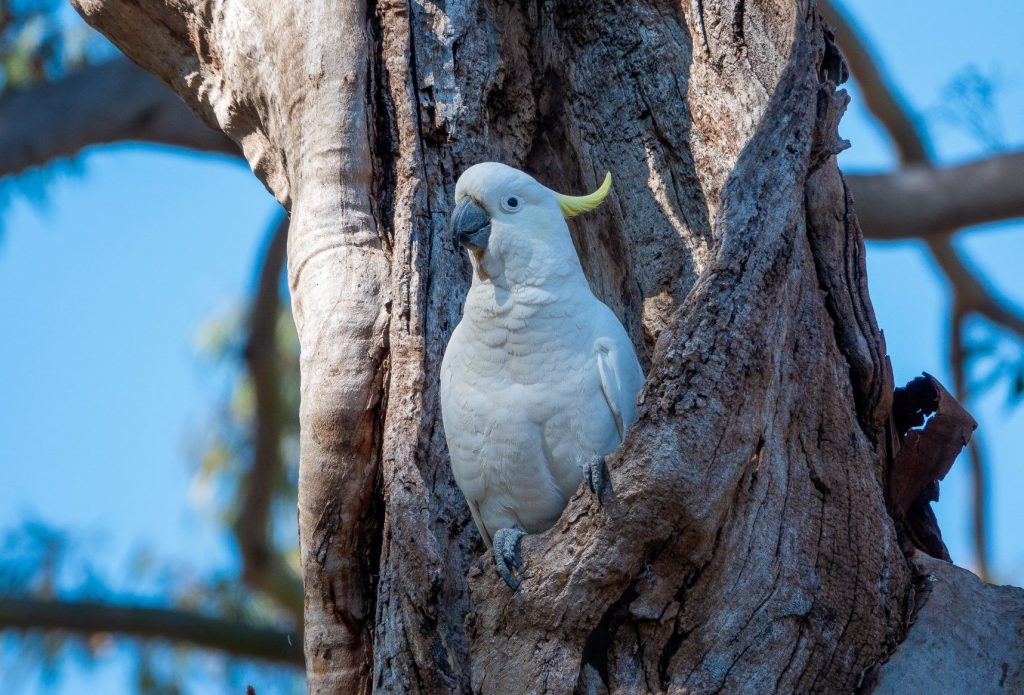
The track is uneven in parts and there are two sets of steep steps but it is worth the effort as along the way there are fine views of the Georges River and Lime Kiln Bay and magnificent displays of native plants, especially in late winter and spring. The park is also a haven for wildlife so keep an eye out for some of the 145 different birds that have been recorded in the area.


1. Rocks give shelter to people, animals and plants
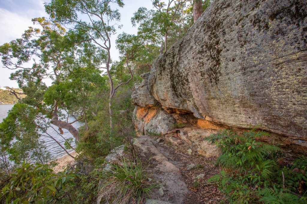
A long sandstone ledge rises 4 to 5 metres above the track. Hawkesbury Sandstone, between 180 and 220 million years old, is the predominant rock in the park. The weathered rock surface takes on different colours from lichen and algae growth: freshly broken sandstone reveals distinct, richly coloured layers. The weathering of the horizontal and vertical fault lines/cracking in the rock has created caves where the Indigenous people from the Bidjigal clan may once have sheltered as they moved through the land harvesting the food sources provided by the river and bush. Small animals, such as marsupial mice and lizards, use the deeper cracks for shelter. In places enough soil and nutrients have fallen into the cracks to support small Tea Trees, a scrambler called False Sarsaparilla, Bracken Fern, Dianella and some sedges. The water view is of a typical drowned valley flooded by rising sea levels between 6,000 and 12,000 years ago. On your left is Jewfish Bay. The mouth of the Woronora River is obscured but is near the southern end of the railway bridge.
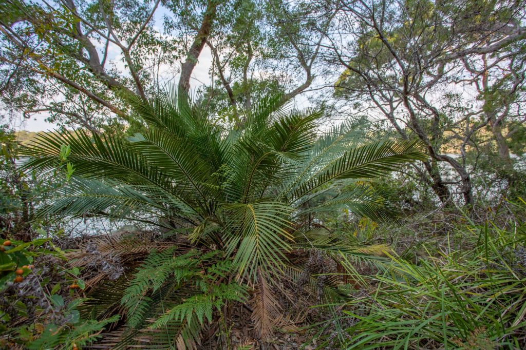
2. Native palm and ring tree
The vegetation grows in sandy soil derived from the Hawkesbury Sandstone and enriched by leaf litter and other organic matter. The eucalyptus trees with fibrous bark are Sydney Peppermints (Eucalyptus piperita) and those with smooth bark and twisted branches are Angophora costata. A Burrawang Palm (Macrozamia) is conspicuous beside the track. This slow growing palm bears a large cone with red fruits. Its seeds are poisonous to eat unless treated. The Bidjigal people would have pounded and soaked the seeds in water for a week, changing the water daily. The pulp was then dried and roasted.
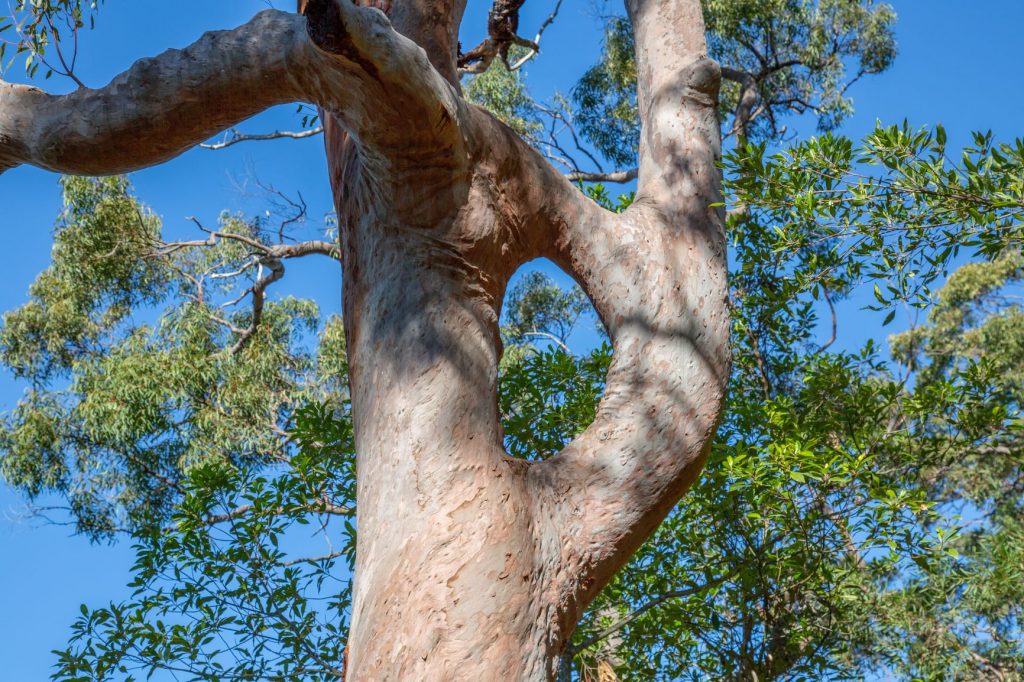
At the water’s edge, washed by high tides are some small mangrove trees. Further along the track these salt dependent trees line the shore of Lime Kiln Bay. Mangroves act as a buffer between the land and the estuary, filtering runoff and improving water quality. They also serve as nurseries for many fish species and feeding grounds for a range of animals including birds and crabs. As you continue along the track look up to your left and see if you can spot the Angophora where a branch has fused with its trunk to form a ring.
3. Fallen rocks and shaded slopes

The track passes between two boulders. Scattered in the bush between the track and the rock face are many such large angular blocks which have come away from the cliff above. The south-east facing slope is shaded for much of the day and protected from damaging winds. The fallen rocks give it additional shade and protection. As a result, you can see many tall trees and shrubs absent from the more exposed areas of the park. The tallest are Angophoras; beneath are Grass Trees, Christmas Bush and Blueberry Ash. The Bidjigal people obtained resin from the trunk of Grass Trees, ate the soft part of the lower leaves and used the flower stem as a fishing spear handle.
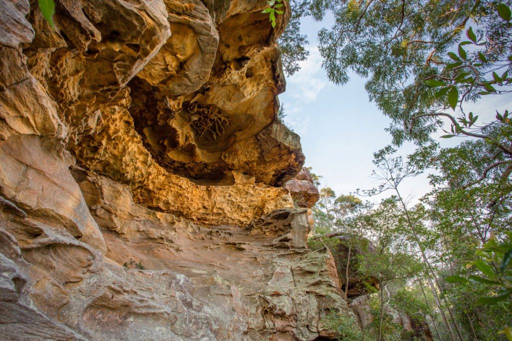
4. Up to Dracula’s Canteen

The steep sidetrack takes you to the base of the cliff. Here there is a large stone overhang known locally as Dracula’s Canteen. The rock face is a beautiful example of honeycomb weathering, exposing its soft orange-yellow sandy texture. One theory is that the pitting results from the crumbling of the rock due to chemical changes in its cementing compounds and the weathering of the softer elements. Return to the main track. Around the track junction is an interesting low shrub with spiny leaves; it is a species of native pine (Podocarpus spinulosus).
5. Mountain Devils and Oyster Farming
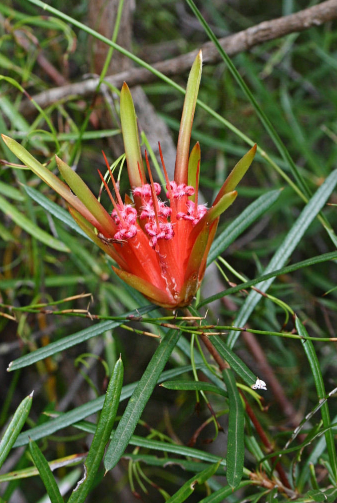
As you continue along the track through the sheltered south-facing slopes of the park, the ground cover becomes denser. How many different plants can you identify? See if you can spot a few of the more common species. Growing along this stretch of track are: Fuchsia Heath, which has tubular red flowers; Honey Flower, with clumps of red flowers and sinister-looking woody fruit giving the plant its more common name – Mountain Devil; Broad-leaf Geebung, a shrub with flaky bark, broad light-green leaves and round fleshy fruit; Sweet-scented Wattle, with pale yellow flowers; Black She-Oak, bearing cones with distinctive valves; Correa, with greenish tubular flowers. At this point there is a fine view across the Georges River towards Illawong and, to your right, Lime Kiln Bay and Lugarno.
For More information on plants see:

Remains of old oyster leases can be seen at low tide. Oysters grew naturally along the Georges River and were harvested by the Bidjigal people and the early settlers. Commercial farming started in the late 19th century and continued until 1994 when the QX parasite infested the oysters, causing the decline of the industry within a few years. Aboriginal oyster shell middens along the banks of Lime Kiln Bay were used by settlers who burnt the shells in kilns to make lime mortar for building. This is how the bay got its name.
6. Looking over Lime Kiln Bay

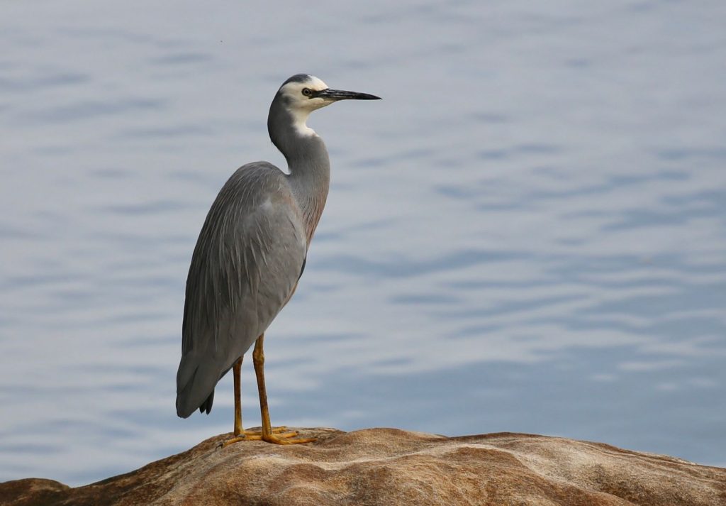
At the top of the steps is an Angophora growing over the surrounding rock. 50 metres beyond this tree, a flat rock provides a convenient rest point and lookout over Lime Kiln Bay and across to Lugarno. A number of old homes were built on the opposite shore. The only access to these in the early days was by boat and an old wharf can be seen. The Georges River was a well-travelled waterway long before roads reached the area. Today such shoreline structures are considered examples of poor planning as they limit public access to the water’s edge and detract from the beauty of the waterway. Water birds are frequently seen feeding on the tidal mud flats below. At least 25 species have been recorded. The most common are White-faced Herons, Pied Cormorants and White Ibises. Common plants near this point include Trigger Plant, Isopogon, Curly Sedge and Mountain Devil. As you continue, there are several large Red Bloodwood trees (identified by their tessellated bark).
7. Hollows for Homes
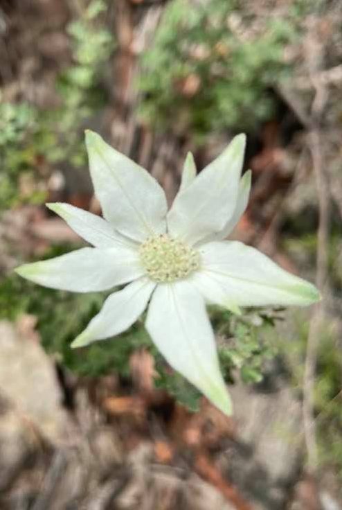
As the track bears around the point, the vegetation changes once more: this area is more exposed and dry. Past fires have promoted the thick understorey of Hop Bush. Flannel Flowers are more common along with Flaky-barked Tea Tree and the winter-flowering green bells of Correa. The dominant small trees are now Casuarina and Broad-Leaf Hakea.
On the high side of the track there are two large, dead trees. These ‘skeletons’ remain a vital part of the park’s cycle of life, providing habitat for native animals. As some trees age they develop hollows in the trunk or branches as a result of wind damage, lightning strikes, fire or insect attack. Large hollows may only occur in very large, old trees (100-150 years). In Australia more than 300 different native species, including some threatened with extinction, are dependent on hollows for shelter and nesting. Even fallen trees serve as shelter to ground dwelling animals and eventually break down, adding nutrients to the soil.
8. A pioneer plant community

Here, below the rock fill used for road making within the park during the 1930s, the vegetation is thinly scattered. Regular fires and exposure to the drying effects of the sun and winds have created a harsh environment. However, leaves, bark, ash and other organic matter are slowly adding nutrients to the soil and some plants are appearing as pioneers in the process of re-vegetation. Grey Gums, Pink Grevillea and Banksia spinulosa occur in this area. The sandstone blocks edging the road and used in building the Castle, were all quarried within the park. The seawall, lookouts and many stone steps were also built using local rock. The track ends at a roadway: cross over, keeping a lookout for cars and bikes. A short track brings you out at a five-way intersection. Taking great care, walk down the hill to your starting point at the Castle car park.
For More information on the Flora of Oatley Park and Sydney Region check out the publications below: